Big Gee in Action


| Album: photos:day10 | |||
|
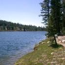
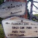
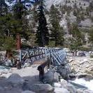
Upper Bear Creek Meadow - below Evolution Valley 22 June 2003 Day 10 Miles: 17.3/122.8 OMG! Right after breaking camp I had to ford a stream. I stripped down to my water shoes and undies and headed across. It was painfully frigid. It was painfully frigid. It was PAINFULLY frigid. I have had to strip down for a few fordings now and it does not get easier with each passing time. This water was snow not log ago. Later this morning Seldon Pass was easily bagged. I was able to follow the trail until the very top and quickly picked the JMT back up on the other side. Kid's stuff. Remarkable how much this area looks like parts of Colorado. I spent lots of time low in meadows and alpine forests between 8,000 and 9,000 feet. It seemed liek I was making slow progress, but I guess I did not do too bad. This is my highest mileage day yet at 17.3, but not by much. It was farther than I expected to go. I was losing my energy as I crossed into the wilderness of Kings Canyon National Park however. I took a number of breaks to sit and watch the waterworks. I would like to watch some kayakers. These are the pristine head waters of the San Joaquin river. I am camped right under the hanging Evolution Valley right near where Evolution Creek drains into the San Joaquin. Noisy but peaceful nonetheless. This is a good site, but if I had walked another 15 seconds I would be in an awesome site with stone and log seats and tables. I came across it when I went for water. Wow, it is 9 o'clock already. I have to turn in. I would like to make Muir Pass tomorrow, but all the PCTers have warned me how bad it is. It is 13 miles away and 3,500 feet higher. The weather has been great so far and today was no exception. Warm with blue sky until the late afternoon when one big cloud formed overhead. |
|||
| Available Images: | |||
 |
 |
 |
 |
| dscn4599 jpg | dscn4600 jpg | dscn4601 jpg | dscn4602 jpg |
 |
 |
 |
|
| dscn4603 jpg | dscn4604 jpg | dscn4605 jpg | |
|
Notice: Undefined index: PATH_INFO in /home/restlessadva/public_html/include/stdBigG.php on line 910 Previous Day [Today] Next Day
|
|||